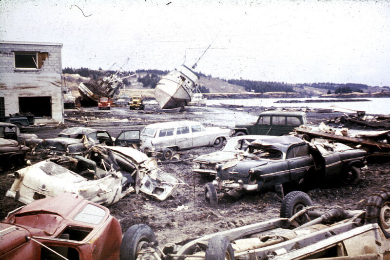
Enlarge / Damage from the 1964 earthquake and tsunami in Kodiak, Alaska. (credit: Education Images via Getty)
On an overcast day in September, Heidi Geagel negotiates familiar potholes on a gravel road in Seldovia, Alaska. Cresting a hill topped with a small chapel, her town spreads out below—in the bay, gently rocking fishing boats; onshore, the Linwood Bar & Grill, the Crab Pot Grocery, and a couple dozen homes on stilts.
Geagel, Seldovia’s city manager, turns around to three people sitting in the back seat, who partner with the United States’ National Tsunami Hazard Mitigation Program and have traveled in from Anchorage and Fairbanks for a meeting with community leaders about tsunami hazards. She points out how much of the landscape could be underwater if one of the giant, fast-moving waves were to hit: “Pretty much the entire map of Seldovia is in the inundation zone, except for this hill.”
Alaska is uniquely vulnerable to two types of tsunamis. The first, tectonic tsunamis, are linked to the long string of volcanic islands that curves like a tail from the state’s southern tip; these islands mark the northern edge of the Ring of Fire, a geologically active zone that generates approximately 90 percent of the world’s earthquakes. Tracing those islands, deep under water, is the Alaska-Aleutian subduction zone, a trench where vast plates of hard rock overlap and friction slowly builds. Once or twice a year, the subduction zone generates earthquakes strong enough to trigger tsunami alerts; every 300 to 600 years or so, it ruptures in a megaquake that sends devastating tectonic tsunamis to Alaska’s shores.
Read 43 remaining paragraphs | Comments

